Extensions for Leaflet Map
Hospedagem WordPress com plugin Extensions for Leaflet Map
Onde hospedar o plugin Extensions for Leaflet Map?
Este plugin pode ser hospedado em qualquer servidor que tenha WordPress instalado. Recomendamos optar por uma hospedagem de confiança, com servidores adaptados para WordPress, como o serviço de hospedagem WordPress da MCO2.
Hospedando o plugin Extensions for Leaflet Map em uma empresa de hospedagem seguro
A MCO2, além de configurar e instalar o WordPress na versão mais atual para seus clientes, oferece o plugin WP SafePress, um sistema exclusivo que salvaguarda e melhora seu site ao mesmo tempo.
Por que a Hospedagem WordPress funciona melhor na MCO2?
A Hospedagem WordPress funciona melhor pois a MCO2 possui servidores otimizados para WordPress. A instalação de WordPress é diferente de uma instalação trivial, pois habilita imediatamente recursos como otimização de imagens e fotos, proteção da página de login, bloqueio de atividades maliciosas diretamente no firewall, cache avançado e HTTPS ativado por padrão. São plugins que potencializam seu WordPress para a máxima segurança e o máximo desempenho.
Extends the WordPress Plugin Leaflet Map with Leaflet Plugins and other functions.
Functions
-
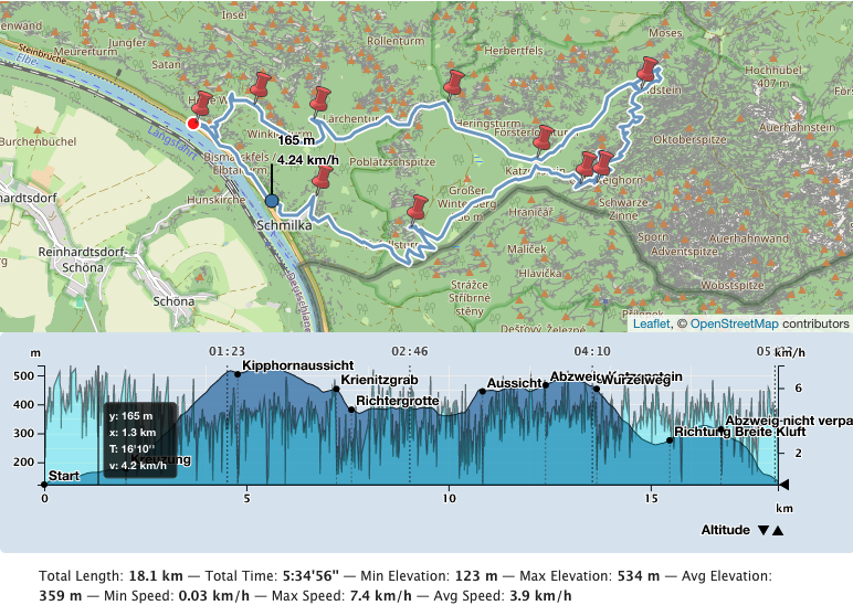
Create an elevation chart profile of a track. There are also acceleration, slope, speed and tempo chart profiles. You can also place multiple tracks on one map.
-
By default Leaflet Map uses tiles from openstreetmap.org or from the tile servers you configured. You can use more and switch between them.
-
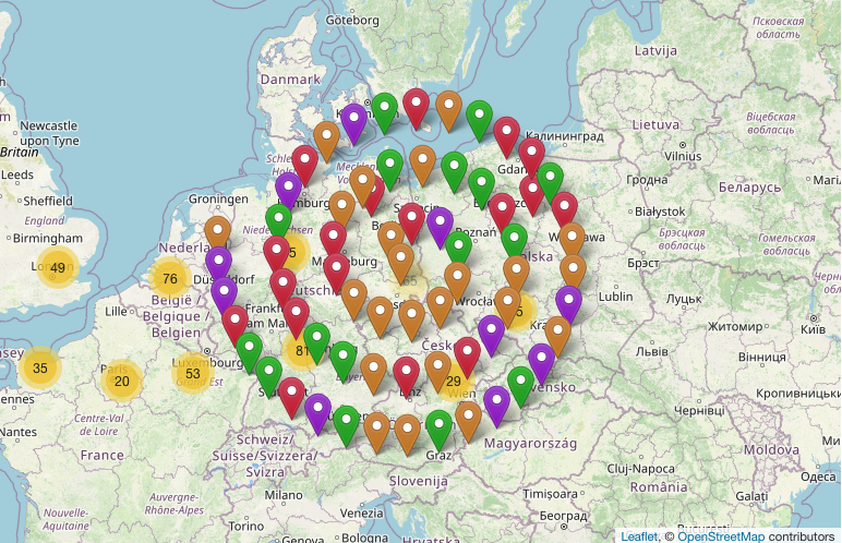
Many markers on a map become confusing. You can cluster and shape them.
-
You can use Awesome markers.
-
You can group the elements on the map by criteria and show/hide them.
-
Create an overview map with geo-locations provided in the pages and posts.
-
Get a tooltip when hovering over an element.
-
You can design a choropleth map.
-
You can display the map in fullscreen mode.
-
Reset the map.
-
Gesture handling
-
Manage your files for Leaflet Map.
-
Help to migrate from WP GPX Maps.
-
and more functions.
Included Leaflet Plugins and fonts
Leaflet Plugins
- leaflet-elevation: A Leaflet plugin that allows to add elevation profiles using d3js.
- Leaflet.GeometryUtil
- Leaflet.i18n: Internationalisation module for Leaflet plugins.
- leaflet-rotate: A Leaflet plugin that allows to add rotation functionality to map tiles
- Leaflet.AlmostOver: This plugin allows to detect mouse click and overing events on lines, with a tolerance distance.
- @tmcw/togeojson: Convert KML, GPX, and TCX to GeoJSON.
- D3: Data-Driven Documents
- Leaflet-providers: An extension that contains configurations for various tile providers.
- Leaflet.Control.Opacity: Makes multiple tile layers transparent.
- Leaflet.markercluster: Provides Beautiful Animated Marker Clustering functionality.
- Leaflet.MarkerCluster.PlacementStrategies: Styling Markerclusters.
- Leaflet.ExtraMarkers: Shameless copy of Awesome-Markers with more shapes and colors.
- Leaflet List Markers: A Leaflet Control for listing visible markers in the map.
- Leaflet.FeatureGroup.SubGroup: Grouping of Leaflet elements by options and features.
- Leaflet.Control.Layers.Tree: A Tree Layers Control for Leaflet.
- Leaflet Control Search: Search Markers/Features location by option or custom property.
- leaflet-choropleth: Choropleth plugin for Leaflet (color scale based on value).
- leaflet.zoomhome: Provides a zoom control with a “Home” button to reset the view.
- leaflet.fullscreen: Simple plugin for Leaflet that adds fullscreen button to your maps.
- Leaflet.GestureHandling: A Leaflet plugin that allows to prevent default map scroll/touch behaviours.
- turf: Advanced geospatial analysis for browsers and Node.js
Font
Documentation
Detailed documentation and examples in German and English.
Thank you
Many thanks to everyone who found errors and provided ideas for new functions.
Capturas de tela

Track with elevation and speed profiles

ExtraMarkers

Grouping and Tree View

Markercluster PlacementStrategies

Tooltip on Hover

Manage Leaflet Map files